Marietta College students now have the option to earn a minor in Geographic Information Systems (GIS), which combines digital mapping with data to answer spatial questions and help solve geographical problems.
“This is a unique opportunity for our students, regardless of their major, to develop a skill that Wired Magazine recently declared to be ‘the new code,’ ” said Dr. Matthew Young, Professor of History, who has been teaching GIS courses the past three years. “While GIS is often described as digital mapping, it is really better understood as learning how to analyze and express geospatial data. The explosion of publicly available data is revolutionizing the workplace, as businesses and the public sector are embracing a technology that has long been an essential tool in geology and environmental science.”
Marietta’s new GIS minor is based on offerings that are only available at larger universities in the region, and because of its interdisciplinary approach, it is designed to complement a wide range of other majors, from the Arts and Humanities to Social and Natural Sciences, as well as pre-professional majors. In addition to Young, Geology professor Dr. Tej Gautam and Biology professor Dr. Erick Carlson also teach courses in the minor.
GIS is also a high-growth industry, generating 330,000 new geo-professional jobs over the last decade.
“Forbes recently published a story describing how undergraduate business and MBA programs are just beginning to embrace GIS in their curricula,” Young said. “What we’re doing at Marietta College is very cutting edge. Wired cites Department of Labor projections that the field will grow an additional 30 percent by 2024. This is great ‘value added’ skills for our graduates, and with the new gen education requiring a secondary concentration it will be an ideal minor for our students.”
Young has been passionate about this burgeoning field for years and is excited to grow what the College offers in regards to GIS. His work — and the work of his students — have also gained attention.
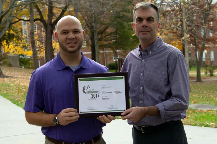
In the spring of 2017, Young and one of his GIS classes worked with the Buckeye Hills Regional Council and Marietta alumnus Bret Allphin ’01 on a downtown parking study.
“I was talking to Matt about the potential project for his relatively new GIS class,” Allphin said. “We wanted to find something that was meaningful for the partner and a good experience for the students.”
The students collected the data on downtown parking and worked with Allphin to develop a map. Allphin was impressed with the work and submitted it to the National Association of Development Organizations to be considered for an Innovation Award — and it was selected the top entry.
“We felt the partnership between Marietta College, the City of Marietta and Buckeye Hills was worthy of recognition, and the result produced was worth highlighting,” Allphin said. “These are the kinds of active partnerships we want to foster across our region.”